![]()
![]()
-
Thomas Fire (2017) - This fire covered a total area of 114,037 ha (281,791 acres), the majority of which burned at high severity. Ninety percent of the Thomas fire overlapped with the southern California study area footprint where data on ecosystem services are available, but portions of the following USGS Hydrological Unit Codes (level 5) were not included: the lower portion of the Santa Clara River, Ventura River, and Rincon Creek-Frontal Pacific Ocean watersheds. Of the area of the Thomas fire that overlapped with the study footprint, we report on the 102,482 ha (253,239 acres) on US Forest Service lands (accounting for 60% of the Thomas fire).
See application of SoCal EcoServe to Thomas fire (2017)
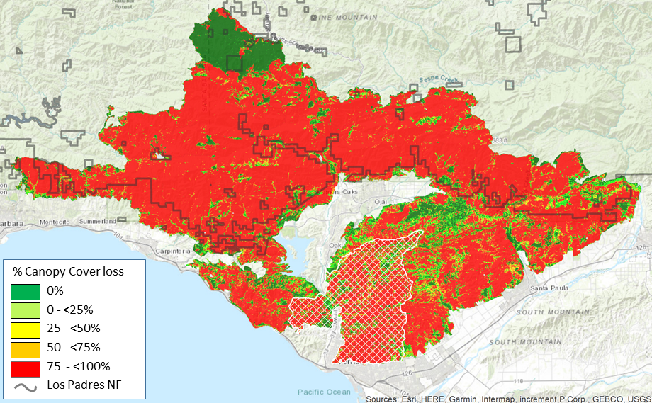
Thomas fire (2017) showing the RAVG Canopy Cover loss classes. White cross-hatched polygon indicates area where ecosystem services data are not available (10% of fire area)